
Marion Previous Residents by Era
A Marion address can be followed across several record eras, but no source covers the whole span. The modern trail begins with the Grant County Assessor, whose parcel data ties the street address to ownership, sales, values, and a legal description. The Recorder then carries that title chain into older deeds. Printed directories and census schedules supply the household layer, while maps and permits date changes to the building. The table separates what each source can actually prove.
| Source | Years It Covers | Where Held | What It Shows |
|---|---|---|---|
| Assessor sales and parcel card | Sales since 2008; annual value history | Grant Assessor and Elevate | Parcel, situs, current owner, sales, values, building facts |
| Recorder deeds and indexes | Online cutoff unstated; books from 1831 | Recorder, Tapestry, counter, microfilm | Owners, parties, recording dates, legal description |
| Marion city directories | Library collection from 1887 to current; selected years | Marion Public Library and State Library | Named occupants, address, spouse or widow notes, occupation |
| Federal census | 1900 through 1950 for this workflow | Library databases and federal images | Household, relationships, birthplace, street description |
| Sanborn maps | Marion sets from 1887 through 1952 | Indiana State Library and Library of Congress | Lot, footprint, use, materials, outbuildings |
| Permit and occupancy files | Archive start not published | Marion Building and Planning by request | Construction, inspection, occupancy, address assignment |
For recent previous residents, fix the parcel first and work back through recorded sales. For an early twentieth-century household, start with the closest directory year, compare the census, and use the deed only to distinguish an owner from an occupant. Older title work may require a counter visit or microfilm. Absence from one year is never proof that a family left.
Keep a dated research log as the chain moves backward. Record the spelling shown in each source, the repository, volume or instrument number, page, legal description and whether the address is a situs or mailing destination. Preserve each source link with the note. A gap between sources is not evidence that the household stayed unchanged; it marks the point where another directory year, newspaper, census schedule or deed image must be checked.
Fix the Marion Address First
Copy the full modern address, ZIP, parcel number, situs address, and legal description from the Grant County Elevate viewer. Situs means the physical location of the parcel. The tax mailing address can point somewhere else, so it should be recorded in a separate field. Grant County's Treasurer warns that older mailing data and forms such as Ninth versus 9th or East versus E can make a direct address search miss.
The parcel and legal description survive many changes that a street label does not. Note the lot, block, plat, or tract when shown, along with the date you viewed the record. That gives every later directory, deed, and map result a common reference point. For a current street-by-street search rather than a backward house trail, use the Marion street directory.
Note: Search the number alone when a full Marion street form fails, then compare every result against the parcel and situs.
Recent Marion Owners Since 2008
The Grant County Assessor says its sales data begins in 2008 and updates weekly. A parcel card can connect the present owner with owner history, recent sale events, value history, land and improvement facts, sketches, photos, and the property location. Those fields create a dated starting point, not a complete list of previous residents. A buyer may not have occupied the property, and another household member may never appear in the owner roll.
Save the parcel number, current owner spelling, sale date, and legal description. Then compare the owner-history line with the actual recorded instrument. Annual assessed values run March 1 to March 1, so a value change is a useful building clue but not a move-in date.
Walk Grant County Deeds Backward
The Grant County Recorder keeps deeds, mortgages, releases, real-estate contracts, plats, surveys, liens, affidavits, and final decrees. Its linked Tapestry system is a paid one-time search and image route, while regular users may use Laredo. The official page does not state Tapestry's oldest online year. That gap makes the office counter and State Library microfilm essential access channels.
- Pull the current owner's exact indexed name and the legal description from the Assessor record.
- Search Tapestry for that owner as grantee near the last sale date. Record the grantor, document number, type, date, book and page.
- Search that grantor as an earlier grantee. Match the legal description before accepting the link.
- Repeat the handoff from seller to buyer. Check final decrees, probate, affidavits, mortgages, and releases when a normal deed is missing.
- Move to the Recorder counter or microfilm when the online trail ends. Grant deed books run from 1831 to 1926, and grantor/grantee indexes from 1832 to 1899.
- Grantor / grantee
- The grantor gives an interest in land; the grantee receives it.
- Chain of title
- The linked sequence of transfers for the same land.
- Legal description
- The lot, block, plat, or tract wording that identifies land even when its street address changes.
The Recorder's copy rules and instrument guidance are visible on the official FAQ. The captured page below shows the source route used for Marion previous residents research.
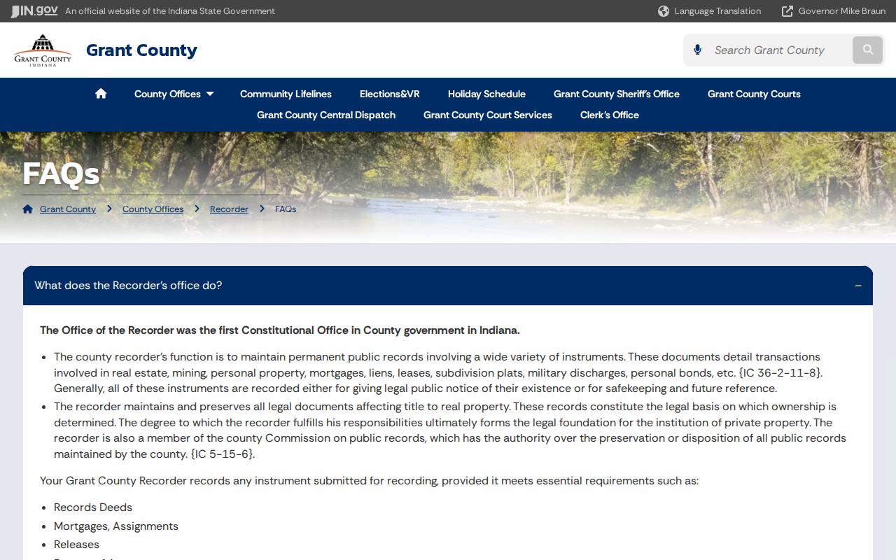
That office guidance helps distinguish an index entry or portal image from a copy supplied by the record custodian.
When Marion Online Records Stop
No online result does not mean no deed exists. The Grant County microfilm inventory lists land records from 1825 to 1926, deeds from 1831 to 1926, a Center Township deed index from 1831 to 1926, grantor and grantee indexes from 1832 to 1899, and a tract book from 1825 to 1857. These reels extend the previous residents trail beyond the unstated Tapestry cutoff.
Ask for a precise book, index, township, party, and year range. The Recorder counter remains the custodian route, while State Library microfilm supplies older access. A known warning belongs in the later estate search: probate index Book 4 is missing from the inventory. Treat that as an index gap, not proof that no will or estate file was created.
Marion Houses on Sanborn Maps
Sanborn fire-insurance sheets date buildings rather than people. Marion appears in sets for 1887, 1890, 1893, 1896, 1901, 1905, 1911, 1920, and later 1931 sequences through 1952. Locate the street and sheet, compare lot position, footprint, materials, stories, outbuildings, and labeled use, then map that shape to the modern parcel or plat. A directory or deed supplies the name that the map usually lacks.
The Indiana State Library Marion year list is the source for choosing the right edition.

The published run makes it possible to bracket a construction or alteration between two map years without assigning an unsupported occupant.
Marion Permit and Occupancy Clues
A permit file can mark construction, an inspection, demolition, an improvement-location procedure, or occupancy. Marion publishes current residential permit and plot requirements, but no public permit-result index was located. Request an existing file by address and date from the Building or Planning department through the city APRA route. Ask for the permit application, inspections, occupancy record, plot, or address assignment that fits the research question.
The city's form supports a focused records request when the website has no searchable archive. Permit applicants are not automatically previous residents, so use the date as a house-history marker and confirm names elsewhere.
Marion Past Residents Beyond Deeds
Ownership is only half the address story. Marion Public Library says its city directory collection reaches from 1887 to the current collection, with selected exact runs also held by the Indiana State Library. An address or reverse section can reveal occupants; the alphabetical entry may add a spouse, widow notation, occupation, or owner and occupant mark. Full details about the volumes belong on the Marion city directory page.
Pair the closest directory line with a released federal census schedule from 1900 through 1950. The directory provides near-annual street continuity. The census adds household relationships, birthplace, and an enumeration district, which is the area assigned to one census taker. Their dates and boundaries differ, so agreement is strong evidence while a mismatch needs another year.
- Find the address entry, then check the same name in the alphabetical directory.
- Repeat in the closest prior volume, allowing for missing years, initials, and spouse listings.
- Match the nearest census by street, household, and enumeration district.
- Use newspapers, obituary and funeral indexes when a name disappears.
Marion Library's Indiana Room holds newspapers from 1867 forward, obituary and funeral-home indexes, cemetery files, and an Estate Book index. Its research request service charges $2 per record, up to ten. Probate, wills, and certified court files remain with the Grant County Clerk; the library index is a lead, not the final file.
Lawful use. Research Marion previous residents for house history, genealogy, estates, and personal curiosity. Never use an address trail to track, intimidate, or harass a living person.
Note: A missing directory year, probate index volume, or online hit calls for another access channel, not a claim that the record never existed.